


Bicycle routes


Roztocze is a picturesque land stretched from Polish Kraśnik to Ukrainian Lviv along a narrow range of hills. It is characterized by dense forests, sparse buildings, silence and a climate unique for the whole country. It is the sunniest area in Poland, where the iodine concentration is comparable to that on the coast. The most valuable forest areas have been protected as part of the Roztocze National Park - the most forested among Polish parks. Numerous landscape parks and nature reserves have also been created here. Due to the unique natural, cultural, and historical values, in 2019 the ...
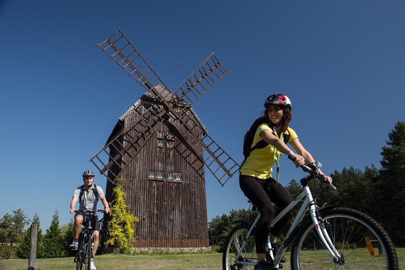
The East of Poland Cycling Trail Green Velo, with length of nearly 2000 km, is the longest cycling route in Poland. It runs through five voivodeships in the eastern part of the country, including Lublin region (circa 351 km). The part of the trail that runs through Lublin Region, leads through, among other places, the scenic areas of the Bug River with shrines of different denominations: in Kostomłoty, Kodeń and Jabłeczna, multicultural cities: Chełm and Włodawa, as well as the Roztocze National Park. ...

red; distance of 288 km First stage: Janów Podlaski – Włodawa (distance of 146 km)Route: Janów Podlaski (0 km) – Wygoda (2 km) – Piaski (8km) – Woroblin (14 km) – Pratulin (22 km) – Krzyczew (27,5 km) – Neple (36 km) – Malowa Góra (38 km) – Koroszczyn (42 km) – Kobylany (46 km) – Lebiedziew (53 km) – Kostomłoty (64 km) – Kodeń (73 km) – Zabłocie (84 km) – Jabłeczna (95 km) – Liszna (102 km) – Sławatycze (105 km) – Kuzawka (108 km) – Hanna (113 km) – Dołhobrody (124 km) – Różanka (133 km) – Suszno (142 km) – Włodawa (146 km) ...
.jpg)
red, distance of 105 km Route: Kazimierz Dolny (0 km) – Dobre (8 km) – Wilków (12 km) – Janiszów (34 km) – Kluczkowice (43 km) – Józefów nad Wisłą (57 km) – Bęczyn (81 km) – Urzędów (83 km) – Dzierzkowice (86 km) – Wyżnica (92 km) – Kraśnik Train Station (105 km) The route starts in Kazimierz Dolny, a scenic Renaissance town situated in the valley of the Vistula River. The most attractive part of the trail leads through the narrow, steep Małopolski Gorge of the Vistula River, natural assets of which are protected within the Kazimierski and Wrzelowiecki Landsca ...

red; distance of 67 km Route: Lublin (Sławinek District, next to the Open Air Village Museum) – Dąbrowica (4 km) – Uniszowice (10 km) – Motycz (14 km) – Miłocin (20 km) – Kolonia Maszki (24 km) – Wojciechów (28 km) – Nałęczów (36 km) – Wąwolnica (42 km) – Kębło (44 km) – Rąblów (50 km) – Rzeczyca (56 km) – Kazimierz Dolny (67.2 km) This route leads through diverse and picturesque parts of the Nałęczow Plateau. Tourists will enjoy the varying natural scenery, beautiful vistas and the challenge of riding through forests, hillocks and ravines. At the end of ...
red; distance of 109.5 km Route: Lublin – Bystrzyca (11 km) – Zawieprzyce (19 km) – Kijany Kościelne (23 km) – Łęczna (32 km) – Puchaczów (39 km) – Bogdanka (42 km) – Kaniwola (48 km) - Załucze Stare (57 km) – Urszulin (64 km) – Hańsk (89 km) – Wola Uhruska (109.5 km) This route is perfect for lovers of nature and active tourism. It stretches along the Lublin Upland and the Łęczna-Włodawa Lake District, a part of the Lublin Polesye. Along the way you will visit e.g. the Nadwieprzański Landscape Park, the Łęczna-Włodawa Lake District Landscape Park and the Pol ...
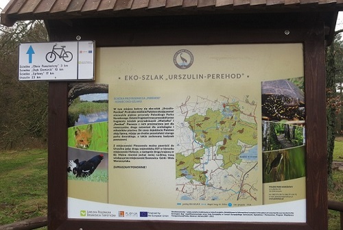
The trail connects all the nature paths of the Poleski National Park: Little Turtle, Spławy, Dominik Oak, Insurgent Camp, Mietiułka (biking trail) and Perehod. Didactic and Museum Centre of the Poleski National Park in Załucze Stare is also located on the trail. The trail is marked in both ways and can be covered either as suggested above or the opposite direction. Route: Urszulin (Educational & Administrative Center) - Dębowiec - Stare Załucze - Zawadówka - Babsk - Wola Wereszczyńska - Jamniki - Lipinki - Pieszowola area (the beginning of the Perehod trail) blue, distance of 22,5 ...